
About Annapurna Region
A Symphony of Culture, Nature, and High-Altitude Adventure
Hidden Hymn
Author
Hidden Hymn writes for Hidden Hymn — long-form stories from the world's quietest corners.
August 23, 2026 · 11 min read
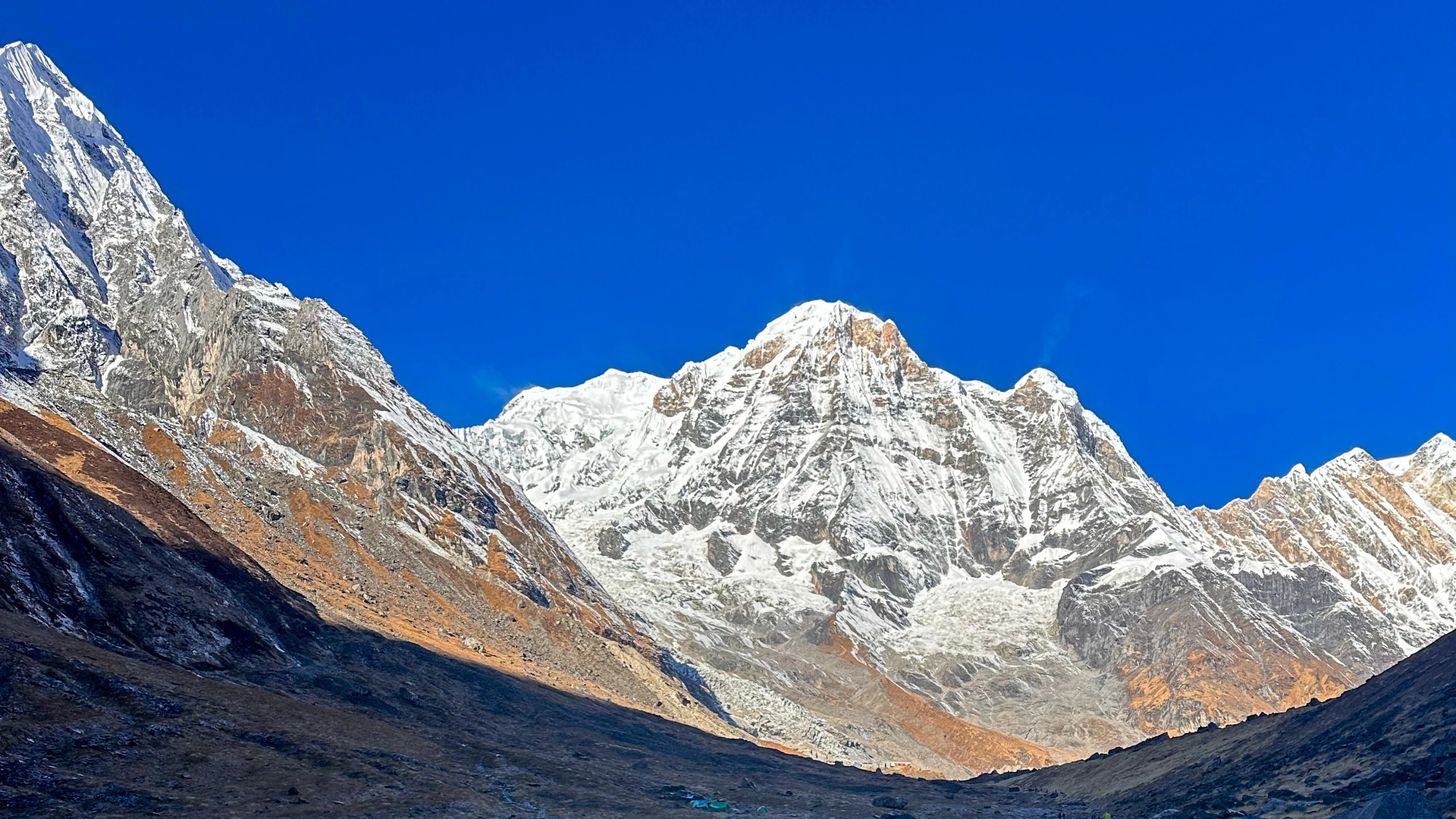
Annapurna region, a legendary stretch of the Himalayas that offers arguably the most diverse trekking experiences on the planet. In Sanskrit, Annapurna literally means “full of grains” but is normally taken to mean “Goddess of Harvests”, an incarnation of Goddess Parvati. The people who named this mountain were not looking up at a summit. They were looking at the terraced hillsides beneath it, at the barley and the millet, at the meltwater arriving on time. They named the highest thing they could see after the most ordinary thing they needed.
Everything worth understanding about this region sits inside that gap between the peak the world came to conquer and the harvest the valley came to depend on.
About Annapurna Region
The Annapurna range is a series of peaks stretching 55 km, Mt. Annapurna I (8091m), the tenth highest summit in the world, and flanked by Annapurna II (7,937m), Annapurna III (7,555m) and Annapurna South (7,219m). Unlike other Himalayan giants, Annapurna I is elusive, often hidden from view by the towering peaks that guard its sanctuary. Gangapurna, Tilicho Peak and Hiunchuli complete the rampart.
Annapurna I is elusive in a way that Everest is not. It hides. The lesser peaks that guard the sanctuary stand between the summit and almost every approach, so that trekkers can walk for eight days toward a mountain they will not properly see until they are standing inside its amphitheatre.
Immediately west, the ground opens. The Kali Gandaki Gorge, cut by a river older than the mountains it divides - separates the Annapurna massif from the Dhaulagiri massif, with Dhaulagiri I (8,167 m) rising just 43 km away. Measured from the surrounding summits down to the riverbed, it is widely held to be the deepest gorge on earth. Walk its floor at Kalopani and there is eight-thousand-metre ice on both sides of you, north and south, simultaneously. There are few places on the planet where geology is this legible.
That gorge is also a door. It is the ancient trans-Himalayan trade corridor along which salt came south from Tibet and grain went north - the reason Thakali culture exists in the form it does, the reason Mustang was wealthy, the reason the Annapurna region has never been a wilderness. It has always been a highway.
Annapurna Conservation Area Project (ACAP)
The entire Annapurna massif is protected within the Annapurna Conservation Area Project (ACAP). Established in 1986, it holds the distinction of being Nepal’s first conservation area and its largest protected region, spanning 7,629 sq. km.
Unlike strict nature reserves, ACAP is a living landscape, home to over 100,000 residents of different cultural and linguistic groups, across five districts: Kaski, Lamjung, Myagdi, Manang, and Mustang. This region is a rich mosaic of cultures: the southern regions are dominated by Gurung and Magar communities, while the northern Trans-Himalayan regions are home to the Thakali, Manange, and Loba people.
To manage this vast area effectively, ACAP is divided into seven Unit Conservation Offices:
-
Trans-Himalayan Region: Jomsom, Manang, and Lo-Manthang.
-
Southern Flank: Bhujung, Sikles, Ghandruk, and Lwang Village.
The model matters because it produced something rare: a protected landscape where the revenue from your entry permit funds the school, the water system and the trail your host family's children walk to reach it. When we talk about reciprocal prosperity, we are not describing an aspiration. In the Annapurna region, it is an institutional arrangement that has been running for four decades.
History & Legend: The Conquest of Annapurna I
The Race for the Roof of the World:
Before Everest was conquered, there was Annapurna. On June 3, 1950, the Annapurna massif became the site of a defining moment in human history. It was here that humanity first broke the "8,000-meter barrier," claiming the first summit of the world's highest distinct zone - the "Death Zone."
1950, The French Expedition & The "Golden Age”:
In the mid-20th century, Nepal had just opened its borders to the outside world, and the Himalayas were largely terra incognita (unknown land). A French expedition led by Maurice Herzog arrived not just to climb, but to explore.
-
The Search: Unlike modern climbing where routes are mapped via satellite, the French team spent weeks just trying to find a path to the mountain. They initially attempted Dhaulagiri, found it impossible, and frantically switched their focus to Annapurna I with the monsoon season fast approaching.
-
The Summit: On June 3, Maurice Herzog and Louis Lachenal reached the summit of Annapurna I (8,091m) via the North face. They achieved this on their very first attempt - a feat of navigation and endurance that is almost unheard of in high-altitude mountaineering.
-
The Price of Glory: The descent became a legendary tale of survival. Plagued by frostbite, snow blindness, and a massive storm, the climbers were carried down the mountain on the backs of their Sherpa companions. Their survival is considered as miraculous as the summit itself.
The Book That Changed the World:
This expedition did more than record a summit; it sparked a global fascination with Nepal. Maurice Herzog’s book, Annapurna, became the best-selling mountaineering book of all time (selling over 11 million copies). Its famous closing line - "There are other Annapurnas in the lives of men" - inspired an entire generation of European travelers to visit the Himalayas.
1977, A Nepali Milestone:
While the French opened the door, it was the local climbers who mastered the house. On October 13, 1977, Sonam Wolang Sherpa etched his name in history as the first Nepali climber to successfully summit Annapurna I. His ascent marked a turning point, symbolizing the transition of Sherpas from supporting roles to leading alpinists in their own right.
The Legacy Today:
Today, Annapurna I remains one of the most technically difficult and dangerous 8,000-meter peaks to climb, maintaining an aura of exclusivity and danger that Everest has largely lost. When trekkers walk the trails of the Annapurna Conservation Area, they are walking in the footsteps of these pioneers who opened the age of modern Himalayan adventure.
Annapurna Trekking Routes: Twelve Ways Into One Massif
There is no single Annapurna trek. There are at least twelve distinct journeys, and choosing badly is the most common error travelers make in this region - not fitness, not altitude. Fit.
Route | Days | Max Altitude (Approx.) | Difficulty | Permits |
Ghorepani & Poon Hill | 4-5 | 3,210 m | Easy | ACAP |
Annapurna Base Camp (South) | 7-12 | 4,130 m | Moderate | ACAP |
Annapurna North Base Camp | 6-10 | 4,400 m | Moderate-Challenging | ACAP |
Mardi Himal | 5-7 | 4,500 m | Moderate | ACAP |
Khopra Danda & Mohare Danda | 5-9 | 3,660 m | Moderate | ACAP |
Sikles | 3-6 | 2,300 m | Easy | ACAP |
Annapurna Circuit | 10-17 | 5,461 m | Challenging | ACAP |
Manang Valley | 7-10 | 3,519 m | Moderate | ACAP |
Tilicho Lake | 10-14 | 4,919 m | Challenging | ACAP+RAP |
Narphu Valley | 10-14 | 5,320 m | Challenging | ACAP+RAP |
Upper Mustang | 5-15 | 3,840 m | Easy-Moderate | ACAP |
Jomsom & Muktinath | 4-7 | 3,760 m | Easy-Moderate | ACAP |
Best Time to Trek the Annapurna Region
The Annapurna region has four usable seasons, not two. The received wisdom - October or March, everything else is a compromise, is the single most expensive piece of bad advice in Nepali trekking.
The reason is geography. The southern flank of the Annapurnas takes up to 3,600 mm of rain a year, most of it in three monsoon months. But the massif itself is a wall. Everything north of the crest - Mustang, Manang, Nar Phu - sits in its rain shadow and stays dry while the south drowns.
Which Season for Which Route:
Season | Southern flank (Poon Hill · ABC · Mardi) | Rain shadow (Mustang · Manang · Nar Phu |
Oct–Nov (Autumn) | Peak conditions, peak crowds | Excellent, cold at altitude |
Mar–Apr (Spring) | Excellent; rhododendron; rising haze | Excellent; Tiji festival in Lo Manthang |
Dec–Feb (Winter) | Walkable and empty below 3,500 m | Very cold; some lodges shut |
Jun–Sep (Monsoon) | Avoid | Excellent, cold at altitude |
October–November: Maximum Clarity, Maximum Company
Post-monsoon air is the cleanest of the year - the rains have scrubbed the dust out and visibility is unmatched. It is also when roughly half the region's annual arrivals appear.
Expect full teahouses on ABC and Poon Hill, and book Chhomrong and High Camp ahead rather than on arrival. Nights at 4,000 m are already below freezing by mid-November, but daytime walking is comfortable throughout.
If you want to see everything, this is the window. You will see it alongside everyone.
March–May: Rhododendron and Rising Haze
Nepal's national flower turns the forests between 2,000 m and 3,200 m into something genuinely difficult to overstate - the corridors above Ulleri and on the lower Mardi ridge in particular.
The trade-off is atmospheric. As the plains heat through April, haze builds and long-distance mountain views soften, particularly in the afternoons. Walk early. Lodges are calmer than autumn, and the high passes are open.
Late May brings the Tiji festival at Lo Manthang - three days of masked monastic dance in the walled capital, and the strongest single cultural draw in the entire region.
December–February: Cold, Empty, and the Best Light of the Year
Undersold, and the connoisseur's season.
Air is at its most transparent. Trails below 3,500 m - Poon Hill, Ghandruk, lower Mardi, the southern villages - remain entirely walkable. Teahouses that stay open are warm, cheap and half-empty, and you will have viewpoints to yourself.
What closes: Thorong La is unreliable to impassable, high camps on Mardi and the Nar Phu passes shut, and lodge availability above 3,500 m thins sharply. Snow can reach ABC.
Bring a real sleeping bag. Unheated teahouse rooms at altitude are colder inside than most travellers anticipate.
June–September: The Rain-Shadow Exception
On the southern flank, the monsoon is exactly what you fear: leeches in the forest, clouds from mid-morning, landslide-prone road access, and mountains you will not see.
North of the crest, it is the best-kept secret in Nepali trekking.
Upper Mustang, Manang and Nar Phu sit behind the wall in near-desert conditions. Trails are dry. Skies are frequently clear. Lodges are empty and rates are soft. In late summer, Mustang holds Yartung - the horse festival, with racing and archery, one of the few remaining occasions when the valley performs entirely for itself rather than for visitors.
You will need contingency for flight delays into Jomsom, and road sections can wash out. Build slack days. This is the single most useful piece of seasonal knowledge in the region, and the one least often acted on.
What Access Actually Costs in 2026
Permit rules in the Annapurna region have changed more in the last three years than in the previous twenty, and a large share of what is published online is quietly out of date. As of this writing:
-
Annapurna Conservation Area Permit (ACAP): NPR 3,000 for foreign nationals, NPR 1,000 for SAARC nationals, free for children under ten. Single-entry, no time limit, no daily rate. One permit covers every trail inside the conservation area - Base Camp, Poon Hill, Mardi, the Circuit. Issued by NTNC; obtainable in Kathmandu, in Pokhara, or online. Arrive at a checkpoint without one and you pay double.
-
A licensed guide has been mandatory for foreign trekkers in Nepal's conservation areas since April 2023, arranged through a government-registered agency.
-
The TIMS card is where the internet contradicts itself, and we would rather say so than pretend otherwise. It was formally withdrawn for independent trekkers in 2023; some Annapurna checkpoints verify only ACAP, while some agencies still issue and charge for a group TIMS. Ask your operator to state in writing which permits they are buying on your behalf and what each costs.
-
Restricted areas - two significant changes: In late 2025 the Upper Mustang Restricted Area Permit moved from a flat USD 500 for ten days to USD 50 per person per day, so short itineraries no longer subsidise long ones. Then on 22 March 2026, Nepal removed the minimum-two-trekker rule across all restricted districts: solo travellers can now hold a restricted-area permit in their own name, though a licensed guide remains compulsory. Nar Phu sits at USD 100 per week in the September–November season, USD 75 outside it.
Note: Fees are set by the government and revised without much warning. Confirm before you book.
The Thing Worth Saying Last
Every year several hundred thousand people walk into the Annapurna Conservation Area. Most will come home with a photograph of a sunrise from a ridge, and that is not nothing.
But this is a landscape where the mountain is named for grain, where a conservation model was built around keeping people in rather than pushing them out, where a French climber's frostbitten memoir waited seventy-five years to be readable by the porters' grandchildren, and where one peak in a range obsessed with summits was permanently left unclimbed.
The map will tell you where Annapurna is. It will not tell you what she is.
That part you have to walk toward, slowly, asking why.